O'Brien Country
The South West Burren including Doolin, Lisdoonvarna and the Cliffs of Moher.
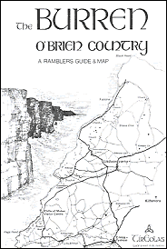
1989, 7pp, 33 b&w illustrations.
One of the most scenic walks in the Burren is to head South on the green road above Fanore, part of the Burren Way, with superb views out to the open sea, the Aran Islands to the West and the mountains of Connemara to the North.
The area depicted on this map faces the great sweep of the Atlantic and
the landscape is the outcome of a long and complex battle between the forces
of nature. The constantly eroding waves beat against the unprotected coastline
and the results are dramatically evident, from the massive 200 metre high
Cliffs of Moher to the extensive sand dunes at Fanore.
From earliest times the sea was a great roadway and the waters off the West Clare coast were the scene of constant boat traffic. It is thought that the first people arrived here by sea. Primitive tools such as stone choppers, hand axes and hammer stones have been found near the village of Doolin, left by the Mesolithic people who lived here between 7000-3500 BC.
Not far to the North is a stone structure, called a court cairn which was
a tomb and also the site of prehistoric ritual.
Many of the churches along the coast were founded by or dedicated to the saints
associated with the Aran Islands. The ruined church at Crumlin is dedicated
to St Columba, who arived there, according to tradition, in a canvas boat
called a curragh, similar to those still in use on the islands.
The ferry to the Aran Islands runs from Doolin and the village is world famous
for the traditional music played locally.
Of the twelve castle shown on this map eight were held, one time or another,
by the O'Brien clan, descendants of King Brian Boru and for centuries the
most powerful family in the area.
The most impressive is Ballinalackan Castle. Set on a high rocky plateau
it is surrounded by a partly intact bawn wall, which has a round-arched gateway.
Finally, in the nearby 19th century Ballinalackan House, now a hotel, the
weary walker can sit by a fine marble fireplace, carved out of a single slab,
and relax over
tea or stronger drink.
A2 map
Euro 3.00
BUY THIS MAP | BACK TO GUIDE & MAP CATALOGUE
For a few more images from the map please click on the numbers: