The SHANNON VALLEY
A Rambler's Guide and Map
The artwork is by Anne Korff, text by Stephen Heery
Format: 580 mm x 785 mm folded to 195 mm x 160 mm
ISBN : 978 1 873821 17 4
Price : € 8.00
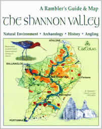
The SHANNON VALLEY covers the area in the triangle of land between Athlone,
Ballinasloe and Portumna and centres on the River Shannon, River Suck
and Little Brosna River. The two-sided, folded guide and map combines
artwork and text to introduce the main heritage features such as Clonmacnoise
and Clonfert but also invites the visitor to explore lesser known sites
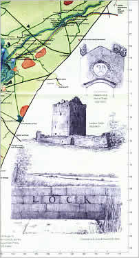
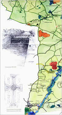
of historical and environmental interest. The map side is in full colour
and depicts bogs, eskers, river floodplains and species of flowers and
birds. It also marks places of heritage interest and includes angling
locations, marinas and long- distance walking trails that traverse the
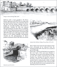
area. The reverse side of the map contains fifteen pages of text, illustrated
by seventeen pencil drawings, to provide information on natural history
and heritage, including castles, Napoleonic fortifications and a wealth
of ecclesiastical sites. Grid references are used for easy cross-reference
between the text, illustrations and the map.
A1 map.
Euro 8.00
BUY THIS MAP | BACK TO GUIDE & MAP CATALOGUE
Tír Eolas also published THE SHANNON FLOODLANDS - A Natural History of the River Shannon Callows by Stephen Heery, 1993.